
Ground Penetrating Services in Ohio
DAYTON

Ground Penetrating Radar Systems of Dayton, Ohio
Ground Penetrating Radar Systems, LLC, is the nation’s largest company specializing in the detection of underground utilities and the scanning of concrete structures. GPRS has an extensive nationwide network of highly trained and experienced technicians in every major U.S. market. When clients hire GPRS, they have the peace of mind of knowing that they have the most reliable scanning technology on their job site and they'll receive the assistance of a technician who can provide them with the most accurate data. For over a decade, GPRS has been the industry leader by providing outstanding service and cutting edge technology, keeping projects on time, reducing safety risks, and putting our relationships with our clients before profit.

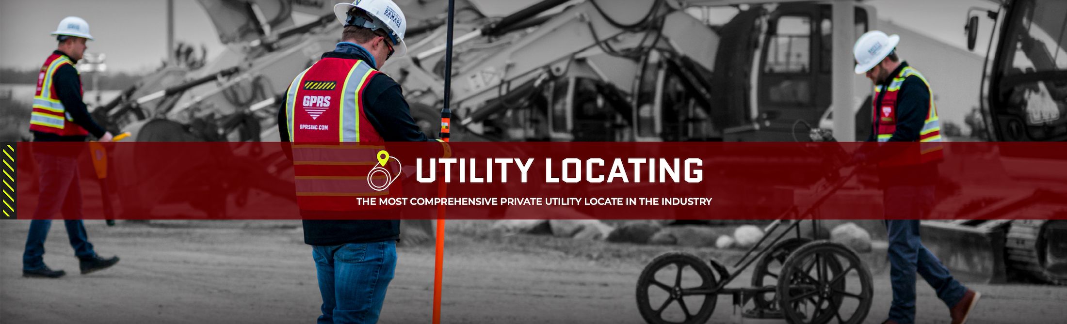
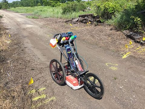
Utility Locating
To ensure the overall timely success of your project, utility detection is critical to any construction project where subsurface excavation is planned. If this critical first step is ignored, the risk for injury increases, budget overruns can multiply, and your schedule can be delayed.
 Ohio")
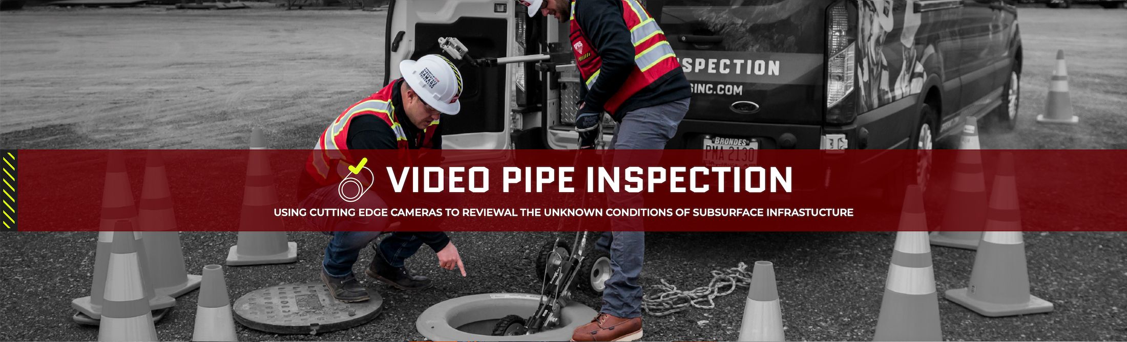
VIDEO PIPE INSPECTION (CCTV)
Video Pipe Inspection (CCTV) is a service used to inspect underground water sewer and lateral pipelines. VPI is a great tool for investigating cross-bores, structural faults and damages, and lateral line inspection.

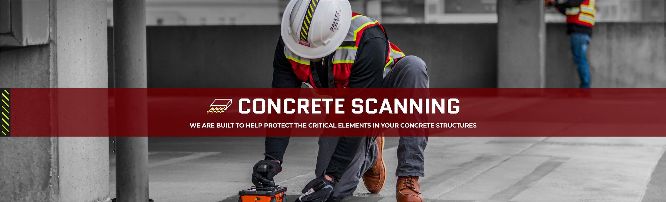
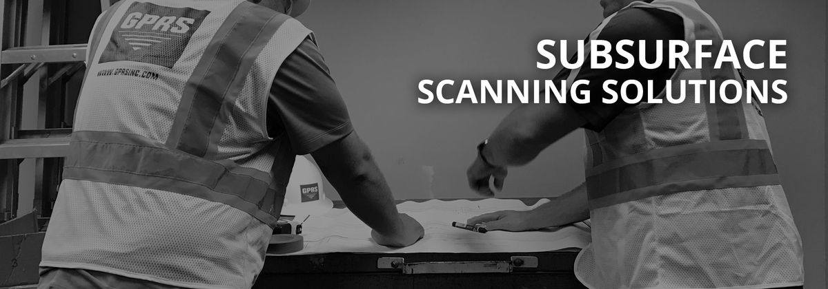
Concrete Scanning
Whether it's a renovation project or new build construction, the likelihood of needing to cut or core concrete is high. There is an inherent risk of striking rebar, conduits, and post tension cables during the cutting or coring process. If a striking occurs, repair costs begin to add up, delays creep into your schedule and it creates a safety hazard for your employees.

3D LASER SCANNING
As-built drawings are often out-of-date and inaccurate, leading to unexpected issues and critical delays. 3D laser scanning provides your team with precise point cloud data and 3D BIM models for reliable project planning, reducing the risk of change orders and project delays. Our 3D laser scanning services provide the link between unknown existing conditions and a true digital twin.

LEAK DETECTION
A water leak detection company that you can rely on, the GPRS team is here to help. We specialize in industrial, municipal and residential leak detection services. We’re experts in underground water leak detection, and our water loss specialists can quickly determine the root cause of the issue and recommend the appropriate fix. In many instances, including emergencies, we will utilize non-destructive testing (NDT) detection methods, including leak noise correlators, to avoid excavation, saving you money and time.

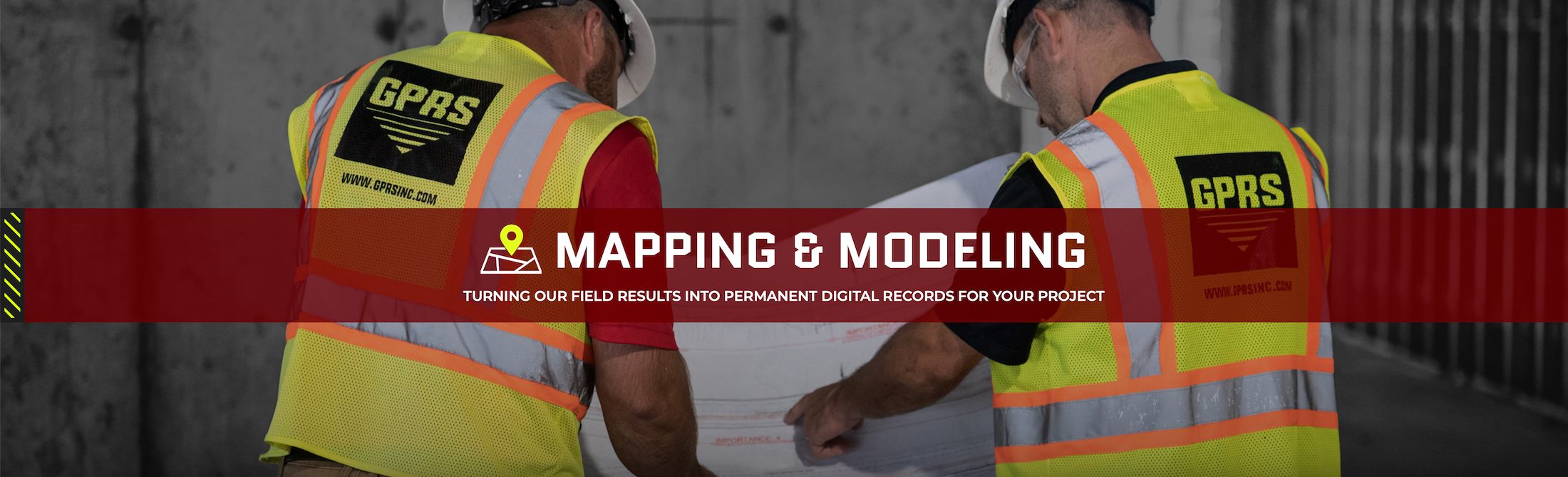
Mapping & Modeling
The goal of the GPRS Deliverables Department is to deliver clear and understandable findings with each of our outputs from field markings to field sketches, KMZ files, or CAD drawings that provide 2D site plans or even 3D CAD models. In addition, upon the completion of every project, our customers receive a job summary that includes job scope information, site photos, description of site conditions, equipment used, and notes from the project.
Decrease the risk of costly repairs and downtime with Ground Penetrating Radar Services’ non-destructive private utility locating services
Ground Penetrating Radar Systems, LLC. is Dayton, Ohio’s largest private utility locating and concrete scanning company. Our subsurface mapping technicians specialize in the use of Ground Penetrating Radar (GPR) to detect private utility lines underground and behind concrete surfaces.
GPRS has some of the industry’s highest trained and most experienced private utility scanning technicians, ready to map what’s below the surface of whatever project you’re preparing to excavate.
For nearly two decades, GPRS has been the Dayton area leader in private utility locating services. Our teams provide outstanding service, utilizing cutting-edge technology, to keep your projects on time and reduce the safety risk to your team.
When clients hire GPRS, they have the peace of mind of knowing that they have the most reliable concrete scanning contractors on their job site. From subsurface utility mapping to concrete structure scanning, our team provides reliable date to keep you team safe.
For more information about the utility locating and concrete scanning Ground Penetrating Radar Services can offer, click here to read the GPRS Overview.
Don’t take a chance with your excavation job. Before you begin your construction or digging project, please contact your local GPRS sales representative, and save yourself time, money and headaches with our expert private utility locating services.
Jared Malone
Mitch Streight
Toledo, OH
Columbus, OH
419-280-1727
614-400-6889
Private Utility Locating Contractor
Utility line strikes are on the rise, and yet many excavation contractors only follow local or state regulations to call “811” before digging. These services are only required to find public utilities, however, leaving the private utility lines to guesswork.
What You Need to Know: Private utility lines exist alongside public utilities, and are not being identified by standard utility locating services. If your project strikes or damages a utility line while digging, you will be responsible for repairing the damages.
Utilizing any private utility locating contractor still may not be enough unless a thorough investigation takes place prior to digging, there is still a lot of risk for a line strike. GPRS has a proven process and track record to not only locate subsurface utility lines, but to provide complete maps after the investigation to help ensure that your dig is safe.
GPRS can provide your team with a wide range of subsurface utility mapping options, from simple field sketches to a full-blown AutoCAD report, pinpointing exactly where buried private utility lines lie. Our advanced reporting will provide you with a permanent utilities location record for future reference. Scan once and make sure your job site is ready for your team to start digging.
Concrete Scanning Services
From hanging signage in a parking deck to installing sanitary lines in a basement, you need to know what’s behind that concrete. Knowing where the critical utility lines in a concrete slab or wall is information that can save you costly repairs, change orders, downtime and potential worker injury. GPRS utilizes the latest concrete scanning equipment to identify utility lines embedded in the concrete, providing fast and reliable layouts marked directly on to the concrete surface.
What You Need to Know: Scanning the concrete to locate subsurface private utility lines will minimize the risks of striking electrical conduits, sewer lines, rebar, post tension cables and more, saving you costly repairs and downtime in the process.
Having a visual representation of what lies beneath the concrete surface provides the driller or excavator the line of sight he needs to perform the job safely and accurately. GPRS can mobilize on short notice, often within hours, to your job site. With concrete scanning contractors in nearly every major market in the United States, our team of private utility mapping contractors is just a phone call away.
We provide the most reliable, most complete public and private utility locating services in the industry. Don’t take a chance with your job. Scanning the concrete first will minimize the risks of striking rebar, electrical conduits, post tension cables and more.
Call GPRS Dayton today to have our team of private utility mapping contractors examine your job site for potential hazards before you dig.
With our industry-leading CCTV video cameras, sewer and pipe inspections have never been easier. With a multitude of other services that include utility locating, concrete scanning, drone imagery, leak detection, and facility mapping and modeling, GPRS has the ability to do it all and do it well. Not only can GPRS Project Managers inspect the interior condition of water pipes, sewer pipes, sewer laterals and manholes — they can provide a map of their location. With our detailed mapping feature on your next VPI project, the GPRS Deliverables Department delivers detailed GPS overlays and CAD files of your underground sewer and water system. This not only saves you money in the future, but it also saves you time by already having an accurate map of your pipeline system in case another blockage, collapsed sewer lateral, or duct causes further problems.
![screen-13.52.18[01.04.2020].png](https://static.spacecrafted.com/bdb3c18a9f2041f7a977423ca88744f8/i/ee7ac2b0820f4d14bae386c66bbe896d/1/4SoifmQp45JMgBnHiEPM6/screen-13.52.18%5B01.04.2020%5D.png)
Featured Concrete Scanning Story
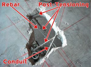
GPRS Uses GPR To Scan Concrete Slab Prior To Core Drilling
Ground Penetrating Radar Systems was recently called by a local construction engineering firm to help analyze a concrete slab for future construction planning. The contractor needed to know information such as slab thickness, rebar spacing, and conduit presence. The building was extremely old and little information about the slab composition exists. GPRS was able to identify the information the client was looking for as well as mark additional obstructions such as beams and conduits that were not thought to be present. Ground Penetrating Radar Systems was able to identify clear areas where the contractor could safely drill and take a core sample for further testing. The relevant details of the slab were then saved, and a detailed report was handed over to the client with the findings. All this information prevents delays on the project and keeps people safe. Striking a conduit can cost a contractor thousands of dollars in repairs, as well as potentially harming the workers drilling on site.
Featured Concrete Scanning Story
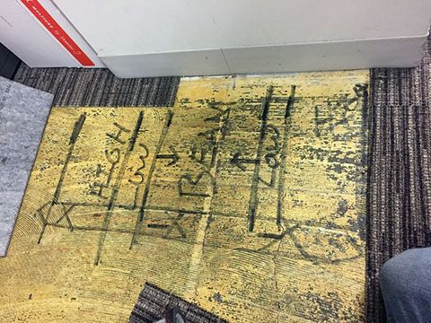
Concrete Slab Scan Prior to Core Drilling
Ground Penetrating Radar Systems was recently called by a local contractor to a renovation project in Westerville, OH. The contractor was core drilling in order to install new electrical feeds near the columns of the building, and needed to know where they could safely core through the slab. The slab featured pan decking construction; this means that we will mark out the high and low areas and recommend that the contractor drill only in the high locations to avoid hitting a conduit in the low areas of the pan.
![screen-13.54.02[01.04.2020].png](https://static.spacecrafted.com/bdb3c18a9f2041f7a977423ca88744f8/i/cbbd5cb0e6c540a0af3bd4bea73c10bc/1/4SoifmQp45JMgBnHiEPM6/screen-13.54.02%5B01.04.2020%5D.png)
Featured Utility Locating Story
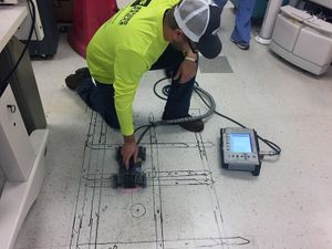
GPR Utility Scanning Used To Locate Underground Utilities
GPRS (Ground Penetrating Radar Systems, Inc.) was recently hired by a local contractor during a project where they plan to build a new addition to an existing building. The contractor hired GPRS in order to locate any utilities in the proposed areas where excavation was to take place. The contractor contacted GPRS in order to determine where the existing utilities in these areas were located so they could make any necessary changes and plan accordingly based upon the located utilities. The contractor also planned to intercept certain utilities such as gas and water to tie new services into the existing lines. Once GPRS arrived at the site, our project managers walked the areas of concern (areas to be scanned) based upon a map of the proposed areas the client sent prior to scanning. This was done in order to determine what utilities were present on the surface in the areas being scanned. Upon completing the walk-through of the areas of concern, the project managers first used the EM Pipe Locator and walked the areas to get a general idea of where utilities which contained either an electrical, or communications signal were present. Once this initial phase was completed, the project managers were ready to scan using Ground Penetrating Radar (GPR).
Featured Utility Locating Story
GPRS scans for conduits or shallow utilities prior to saw cutting
Ground Penetrating Radar Systems was recently called by a local contractor to scan an existing space that was being renovated in Beaver Creek, Ohio. The contractor needed to saw cut the concrete slab in multiple areas to install new plumbing and electrical conduits. The space had been renovated, and there were no drawings that showed what utilities existed under or within the slab.