Private Utility Locating for Airport’s New Parking Garage & Rental Car Facility
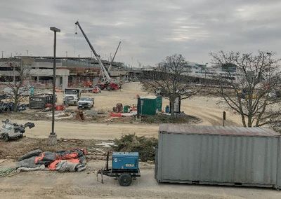
GPRS recently completed a private utility locate at CVG International Airport in Hebron, KY. The scope of the project consisted of the addition and removal of entrance ramps from a highway, and the building of a new parking garage (designed to hold rental car companies much closer to the main terminal). When contacting us about this project, the contractor stated that they needed to determine as much of the underground infrastructure as possible due to this being an “exploratory option”, to determine if they would be able to continue with certain designs and plans previously engineered. They had a set of original blueprints from when the airport was designed but didn’t know anything about what underground infrastructure was still there, what had been removed, and exactly what had been installed from the get go etc.
Upon arrival, GPRS walked the site with the contractor’s representatives throughout the proposed excavation areas. There were multiple utilities visible that needed to be located, but there were also many that weren’t visible that GPRS would end up discovering. As with any project of this nature, it was important to walk the site, and review the limitations within the proposed area, and path of excavation.
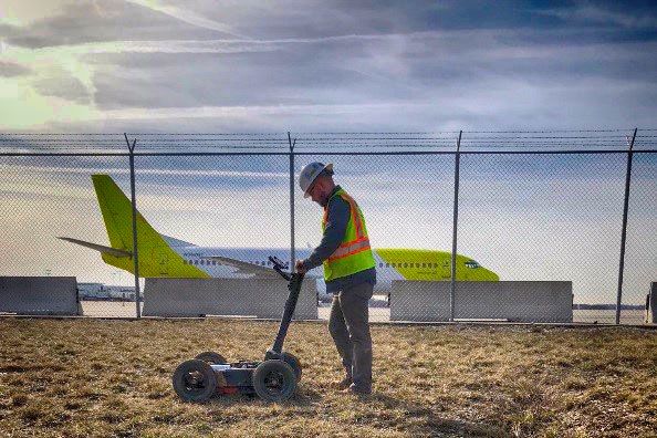
Once the locating activities began, we used a Ground Penetrating Utility cart and performed a radar scan on the dig site. A grid pattern was established and scans were conducted throughout the area. In many areas, the radar revealed utilities that crossed directly across the dig path. Once the GPR scanning was completed with the ground penetrating radar utility cart, we coordinated our findings with the contractor’s on-site contact. We explained our max scan depths which we were able to see utilities at, what we found, and what the markings meant.
After we scanned the proposed dig path with ground penetrating radar, we then used our EM Pipe Locator. We directly connected and clamped to all visible utilities. The first utility that we located with the EM locator was connected to the site lighting. After that, we clamped to all the utilities visible within the work area. As is typical in utility locating, there was one utility that was not able to be toned or located with the GPR, however GPRS used what’s called a “Rodder”. This is a fiberglass rod that allows the technician to trace utilities that are either non-metallic or do not have an electromagnetic frequency. The rodder allowed us to trace the utility that would have otherwise been unable to be located.
As part of our standard operating procedures, passive sweeps with the EM locator were performed to locate any unknown utilities passing through the area. This process is commonly performed in a grid pattern as well to ensure that we detect every possible utility. For this particular project, this was extremely useful. There were so many unknown factors and possibilities of utilities throughout the work path, that passive locating was essential. We were able to identify multiple utilities that would have otherwise been unlocatable due to access limitations, incorrect blue prints, and site knowledge.
After the utility locating was complete, we performed GPS mapping. This service provides our clients with an important visual representation of the locate boundaries, the underground infrastructure that was located, along with depths to the top of the utilities. Whenever possible, we color code the utilities found in accordance with ASCE Standard 38-02. The GPS utility information collected on site was directly transposed onto Google Aerial Maps image in real-time at the site. Within a short amount of time, the information was reviewed and submitted to the contactor in .PDF and .DWG formats. The contractor was then able to take this information and add it as a layer within the construction CAD drawings.
Utilizing GPRS’s proven process will lead to lower utility strikes and save companies from the unexpected find when excavating. Give GPRS a call prior to your next project.

